Let's Talk ! ![]() 954 342 5676
954 342 5676 ![]() +44 137 243 2466
+44 137 243 2466
By: Prem Khatri
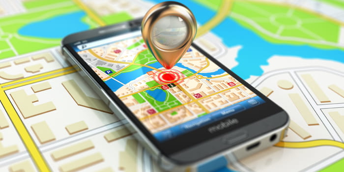
REQUEST A CONSULTIndoor navigation and drone mapping software refers to a promising technology that assists in aiding navigation within the buildings. Outdoor navigation mainly focuses on GPS systems, but they cannot guide you through interior buildings, hallways, or rooms. Because GPS signals are not strong enough to reach indoors, an indoor navigation system is required to do precisely that.
Generally, indoor navigation depends on Wi-Fi to offer an unparalleled accuracy level where the standard GPS systems don't work. In reality, GPS systems generate vague results when utilized outdoors, but indoor navigation relies on location-based landscape application for drone positioning. This technology combines the blueprints of a building with the available technologies, such as Wi-Fi, to provide unmatched levels of accuracy.
Although indoor navigation isn't as common as outdoor navigation, it's starting to gain more ground. This technology is making significant steps in the indoor arena from aiding Product Information Management (PIM) in warehouses and even to helping blind people move around with ease. In reality, indoor navigation technology is transforming the lives of many across the world in many ways. This technology assists unfamiliar students, employees, patients, and visitors get around interior locations.
An indoor navigation system or indoor positioning system can be utilized by a variety of sectors and environments. Apart from assisting individuals in locating where they would like to go and how to get around different buildings, these systems also offer beneficial information to building managers and facilities coordinators. They are used to provide information through software app development. The solution provides tangibles between the obscure and hidden via digital experiences. Some of the most common industries that use indoor navigation systems include:
In the healthcare sector, employees, patients, and visitors can utilize indoor positioning systems to find their way through the many departments in a hospital. This technology can alleviate the stress of navigating different hallways in a hospital, especially in a time-sensitive or stressful situation. During the drone mapping software development, different pieces of hospital equipment can also be tagged to transport and deliver supplies. The location-based technologies are programmed and the indoor navigation software is deployed with tracking capabilities to lead the hospital staff to them when necessary.
In the retail industry, customers can use it to improve their shopping experience. Often it is a bit challenging to find merchandise in big supermarkets and malls. Indoor drone mapping software comes in handy, especially when it comes to locating specific stock items. Indoor navigation system makes shopping in stores and locating popular items easier to find. Marketing personnel are able to collect and use live customers data to sway shopping choices. It can also help in configuring merchandise layout based on the products that shoppers need the most.
Locating restrooms, desks, offices, or conference rooms in a large facility can be pretty easy with a smart office indoor navigation system. Also, employees can easily locate empty and available conference rooms when they are looking for places to hold meetings. Besides locating places and people, adding company assets such as HVAC systems, wiring closets, printers, and other tools during indoor positioning systems development can help employees and maintenance personnel locate these assets when they want to use or service them.
Many universities are beginning to implement smart campus technologies to boost security, to facilitate collaboration, save money, and enhance the efficiency of the available resources. Indoor navigations systems make the institutions a more enjoyable and connected place for visitors, students, and employees.
The indoor navigation systems assist in the movement of firefighters in buildings to help save lives and property. The drone mapping software is also vital when it comes to identifying the location of the firefighting equipment that exists in a building like extinguishers and hydrants.
Nowadays, almost every industry that requires visual inspection as part of its routine maintenance procedures is using drone inspections. Drone inspections usually help inspectors avoid the need to place themselves in harmful situations by using drone GIS technology to collect visual data on the status of company assets.
Wayfinding technology can work pretty well beyond the standard point-to-point navigation. Integrating indoor mapping and navigation software allows routes to get altered to take into consideration barriers or issues such as security alerts and broken elevators or escalators. If an escalator breaks down, the navigation system can easily guide the users to a different lift or a set of stairs. Similarly, in the event of emergencies, the users will be directed to the fastest and best routes to safety. Smart parking lots reduce a fair amount of stress and friction in our day-to-day lives. Employees and visitors alike usually benefit from the new smart parking technologies that utilize indoor navigation and mapping. They give users the chance to reserve parking spaces at entrances nearest the part of the building they'll be hoteling in before arriving in the office or holding a meeting. That will save time for an individual who doesn't have time to go through rows of parked cars trying to locate one that's close to their office.
Sanitation technology is also able to leverage indoor navigation and mapping software. While UVC disinfection practices has been around for many years to keep pathogens off surfaces and out of drinking water, indoor drones have allowed the mechanization of this process. The short-wave ultraviolet light lamps that drones can be equipped with –which is normally harmful to humans – interrupts the pairing of the DNA base, which in turn leads to the creation of pyrimidine dimers that cause the death of viruses and bacteria, and sterilizes surfaces. Additionally, the use of UVC lamp-equipped drones that use indoor navigation and mapping technology reduces the need for traditional cleaning products that release ozone and other chemicals into the atmosphere and water, making this an environmentally sustainable solution as well.
Indoor navigation and mapping software is an essential investment for organizations or businesses. Having the right navigation system for interior businesses alleviates stress and saves time. Chetu offers a variety of business navigation and mapping solutions that meet the unique needs of your business. We implement the latest technologies for utilization in indoor drone navigation into our indoor positioning systems development. Our drone mapping software development team offers sanitation and disinfectant software solutions utilized by schools, hospitals, shopping malls, stadiums, and public transport, among other places. Our indoor mapping and navigation solutions will not only suit your unique needs today, but also in the future.
Disclaimer:
Chetu, Inc. does not affect the opinion of this article. Any mention of specific names for software, companies or individuals does not constitute an endorsement from either party unless otherwise specified. All case studies and blogs are written with the full cooperation, knowledge and participation of the individuals mentioned. This blog should not be construed as legal advice.
Chetu was incorporated in 2000 and is headquartered in Florida. We deliver World-Class Software Development Solutions serving entrepreneurs to Fortune 500 clients. Our services include process and systems design, package implementation, custom development, business intelligence and reporting, systems integration, as well as testing, maintenance and support. Chetu's expertise spans across the entire IT spectrum.
- See more at: www.chetu.com/blogs
Contact Us
Headquarters & Delivery Center
1500 Concord Ter.
Suite 100,
Sunrise, FL 33323
Join the conversation
Privacy Policy | Legal Policy | Careers | Sitemap | Referral | Contact Us
Copyright © 2000-2024 Chetu Inc. All Rights Reserved.