


Blog
Chetu’s Esri ArcGIS Mapping Solutions
Let's Talk ! ![]() (954) 862 3937
(954) 862 3937
Our certified Esri GIS experts have tremendous backend industry experience in telecommunications, transportation, AEC, retail, real estate, and more. Additionally, Chetu’s highly regarded expertise in building custom geo-enabled applications that can automate workflows and increase business efficiency makes us the go-to ArcGIS application development company to rely on for all of your unique app development needs.
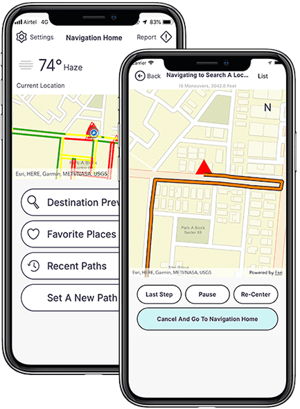
Our ArcGIS consultants configure and implement customizable location data and geospatial analytics modules within your ArcGIS platform as a comprehensive Platform-as-a-Service (PaaS) to streamline workflows, improve operations, and meet all of your unique business needs.
We know that your business is unlike any other. That’s why we’re prepared to provide the most out your Esri software and tailor it to your workflows and operations – maximizing efficiency and benefits.
We’ll integrate our Esri solutions into your existing systems and enable improved collaboration among your teams and easier data exchange. As a result, from the insights you’ll derive to the workflows you engage in, you’ll see enhancements across the board.
Performance is key with any software. Therefore, we’re dedicated to perform troubleshooting and ongoing monitoring alongside other support services so that you can spend less time down and more time delivering.
Whether you require data migration or conversion stored in a BI data warehouse, ERP system, CRM solution, or other business processing system, Chetu will help you maintain 100% data integrity throughout the entire process.
We leverage ArcGIS 3D Analyst, ArcGIS Pro, ArcGIS Image Server, ArcGIS Online, and several other ArcGIS products to visualize, create, and manage high-quality aerial (drone) and terrestrial LiDAR mosaic datasets and 3D scenes.
Along with implementing Esri ArcGIS tools with existing systems, we engineer custom ArcGIS solutions, applications, extensions, and plugins to extend your system functionality, providing a solution that best fits your unique business needs. We’ll also leverage AI to transform workflows, deploy real-time predictive modeling to elevate project quality, reduce expenses, and create actionable data insights.
Our AI specialists design powerful, predictive analytics and modeling algorithms to forecast future data-driven outcomes accurately. Chetu programs AI-driven analytics to provide project managers with enhanced decision-making data to study all project metrics in diverse environments.
We’ll implement cutting-edge pattern mining and modernized Machine Learning (ML) to glean insights through analyzing potential risk factors and established patterns. We’ll also collaborate with urban project planners and traffic management personnel to further bolster the accuracy of your insights.
At Chetu, we leverage custom IoT solutions to effortlessly implement Esri GIS into your software environment. Consequently, you’ll be provided accurate maps and geography details to promote actionable insights to drive decision-making processes – all in real time.
Our Esri developers leverage the ArcGIS REST API for Python, JavaScript, C#, and PHP to allow us to work with the ArcGIS platform through web services and perform, assist, and automate a variety of scripting server administration tasks within ArcGIS Server.
Our Esri developers have extensive experience leveraging ArcGIS Pro’s geoprocessing tools, enabling us to build an infinite number of custom tools that automate repetitive GIS tasks, solve complex problems, and perform advanced spatial analysis.
We leverage Esri’s GeoEnrichment module to retrieve information about the people & places in a specific location or area within a certain distance from a location, such as demographics (population, income, housing, consumer behavior, and natural environment.)
Available with ArcGIS Enterprise, our development experts perform advanced Raster Analysis (within the ArcGIS Raster Analytics module), that incorporates terrain analysis, vegetation analysis, suitability analysis, and persistent imagery product generation.
Leveraging the ArcGIS Data Interoperability Extension enables our developers to customize your file formats and dataflows by creating or modifying spatial ETL (extract, transform, and load) tools within the FME Workbench visual workflow editor.
Using ArcGIS Web AppBuilder, our programmers can configure and customize your fully featured HTML/JavaScript application using many out-of-the-box widgets, along with customizable templates, themes, maps/scenes, and attributes.
Our experts can develop advanced analysis and monitoring tools with an aim to help streamline logistics, improve overall security protocols, and even enhance air traffic management. Take a visual approach to your decision-making and make passenger satisfaction soar.
Upgrade your infratructure with our Esri ArcGIS solutions; improve your traffic analysis, asset management, and route planning with the use of real-time special data presented by advanced analytics. We’ll help you optimize your operations and boost your transportation network overall.
Want to improve your sustainability and productivity? With our Esri ArcGIS solutions we’ll enable you maximize yields and be as efficient as possible with tools for land management, crop monitoring, and even precision farming.
With how in-depth the AEC industry is, we’re proud to be capable of delivering a streamlining solution that makes the planning, designing, and construction processes easier. Our applications will be specifically crafted to meet your task and budgetary needs.
Build the gap between Geographic Information Systems and Building Information Modeling with our developers’ Esri ArcGIS solutions. We’ll merge these datasets to deliver valuable insights that’ll help your decision-making within the realm of building and infrastructure projects.
Tailoring our Esri ArcGIS solutions to fit your telecommunication needs with features like asset management capabilities, network planning, and customer service optimization; harness the comprehensive aid of Chetu.
As an Esri Silver Partner with certified Esri GIS experts, Chetu offers support services for Esri applications. Whether it’s troubleshooting, advanced customization, management, analysis, and distribution of raster and imagery data collections, we’re ready to help.
We offer comprehensive support services and assist with account creation and setup, map configuration and design, and cloud-based GIS functionality of an ArcGIS-based SaaS platform. We also offer cloud-based GIS functionalities and content management, data hosting, analytics, real-time reporting, and more.
We can seamlessly transfer geospatial data from various and diverse sources into your ArcGIS platform. Using System Design Strategies that align with ArcGIS specifications, your data is converted, mapped, and structured within ArcGIS – ensuring data integrity and mapping performance stay intact.
Our experts can support scalable infrastructure, define new workflows, and integrate GIS components as standalone services or as integral parts of your platform. We can design system architecture for a seamless and effective platform that meets or exceeds your business goals.
We create, upgrade, and maintain Esri GIS software to encompass a wide range of digital mapping products. Furthermore, our support includes map production and creation, geospatial data mapping including thematic data mapping, spatial analysis using advanced GIS tools, and more.
Our team are equipped to deliver comprehensive assistance for your cloud ArcGIS solutions. Whether you help with new installations and continuing management of cloud-based GIS infrastructure, migration planning, architecture design, or even QGIS (Quantum GIS) solutions – we’ve got you covered.
Our experts leverage ArcGIS spatial analysis techniques from your topographic mapping utilizing data use geospatial analysis to obtain meaningful geographic data. This data can then be leveraged by you to understand your network, its relationships, and trends.
Drop us a line or give us a ring. We love to hear from you and are happy to answer any questions.
REQUEST A CONSULTContact Us
Headquarters & Delivery Center
1500 Concord Ter.
Suite 100,
Sunrise, FL 33323
Join the conversation
Privacy Policy | Legal Policy | Careers | Sitemap | Referral | Contact Us
Copyright © 2000-2024 Chetu Inc. All Rights Reserved.