


GIS IN TRANSPORTATION: LOCATION INTELLIGENCE FOR YOUR TRANSPORTATION BUSINESS
Let's Talk ! ![]() 954 342 5676
954 342 5676 ![]() +44 137 243 2466
+44 137 243 2466
Location-based apps are our expertise. We provide location-based services and geolocation apps development. Our GIS consultants deploy custom mobile solutions. Our expertise includes GEO-positioning and GPS coordinate processing. We design location-based games, fitness apps, virtual and augmented reality. Our LBS engineers build applications on any platform including Android and iOS.
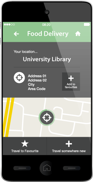
Today, It's a must for businesses with dedicated apps to include a feature for locating the closest store or service provider. We design world-class location-based applications with GPS tracking modules that offer highly accurate driving estimations, dynamic condition filtering and easy-to-understand interfaces that encourage repeat usage.
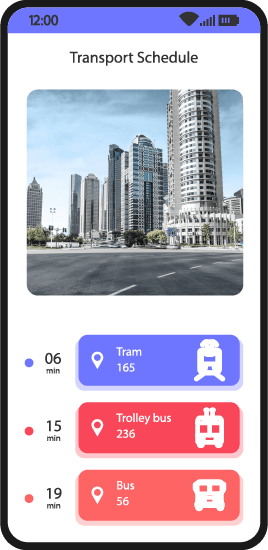
Our developers program GPS-based applications capable of integrating with third parties, such as weather and traffic apps, through custom APIs. We program real-time routing and re-routing software for efficient fleet and logistics management with integrated location-based software and GPS tracking technologies.
"Checking in" has rapidly become one of the most used functions in social networks and one of the most beneficial for a wide variety of businesses. We have experience building and integrating social media apps with location-based features, including location-based tagging, for uses ranging from infotainment to emergency services. Our solutions allow products & services to be pointed to mobile device users.
We build digital marketing apps with location-based capabilities, including location-specific push notifications. Geofencing technology enables businesses to automate marketing material pushes to customers' mobile devices upon entering a preset area (near a retail location, for example).
Maintaining visibility on every one of a company's assets, whether that's IT equipment, heavy machinery or human assets, is critical for keeping operations running smoothly and revenue generating. We leverage technologies like barcodes, RFID trackers, NFC tags and IoT scanners to update centralized databases in real time when assets are moved.
We develop mobile field service applications that let employers keep track of their entire workforce from one user location. Our location-based development solutions include geolocation apps with abilities to locate individual field workers, track deliveries, route drivers, handle dispatching operations, track assets and maintain a database of location-specific events.
We provide geo-fencing solutions with integrated alert triggers for targeted messaging and email communications. We also perform geo-tagging software development with custom modules to integrate with photo applications, and remote sensing devices (RFID, barcode, QR scanners).
Our LBS software specialists know their way around the code and development environment of the most popular geo-location software offerings, including Google Maps, Waze, Apple Maps and MapQuest. We are able to configure and incorporate these services into any mobile, desktop or web app to create unique, feature-rich map experiences.
We utilize the native location based hardware features built into devices such as phones, tablets and smartwatches to create apps, games and software for VR, iOS and Android etc. We develop location based apps with integrated Apple Maps, Bing, Google Maps and Waze mapping features.
For over 30 years ESRI has been providing businesses with essential geographic information. ESRI solutions help manage and analyze GIS data. ESRI offers a variety of possibilities for integrating GIS technology into any business. From personal desktop systems to enterprise LBS structures. ESRI LBS solutions are flexible and tailored to meet the users' requirements. We partner with ESRI to help you start, develop, and maintain the success of your business.
We integrate Bing Maps V8’s universal mapping controls available for both PC and Mac browsers as well as mobile platforms. Bing Maps’ API is ideal for web-based applications with support for JavaScript and TypeScript. We build native map experiences for Android and iOS apps using Bing Maps features and services. We develop Unity-based applications that utilize Bing Maps 3D data. We utilize Bing Maps’ REST Services to build location intelligence functions such as geocoding, reverse-geocoding, time zone lookup. We provide spatial data services that provide point of interest (POI) and batch geocoding.
We develop custom applications that incorporate Waze tools to share parking lot locations, event venue details, and navigation instructions for drivers. We embed Waze’s navigation framework into our app allowing users to utilize navigation features without leaving the app. We utilize Waze Audio Kit to integrate podcasts, audiobooks and music into your app. We create feeds that provide information on traffic conditions, alternate routes, accidents, and food/rest stop locations.
We develop dynamic apps that utilize Google Maps API. We add rich details for millions of places to apps and provide autocomplete results for user queries. We convert between addresses and geographic coordinates with geocoding API and program geolocation features that provide location data without relying on GPS. We integrate Google Maps directly into ride-sharing apps to improve navigation. We provide immersive real-world 3D structures with up-to-date global data for Unity based games.
We develop apps that use MapKit to display interactive maps with custom annotations, highlighted regions, and overlays. We allow users full control to pan, rotate, zoom, and move the map around in 3D, and show users their current location or guide them to their next destination using direction APIs. We use MapKit JS to integrate Apple Maps into your webpage. We provide Indoor Mapping Data Format to give a model for any indoor location, providing a basis for orientation, navigation, and discovery.
Drop us a line or give us a ring. We love to hear from you and are happy to answer any questions.
REQUEST A CONSULTContact Us
Headquarters & Delivery Center
1500 Concord Ter.
Suite 100,
Sunrise, FL 33323
Join the conversation
Privacy Policy | Legal Policy | Careers | Sitemap | Referral | Contact Us
Copyright © 2000-2024 Chetu Inc. All Rights Reserved.