Let's Talk ! ![]() 954 342 5676
954 342 5676 ![]() +44 137 243 2466
+44 137 243 2466
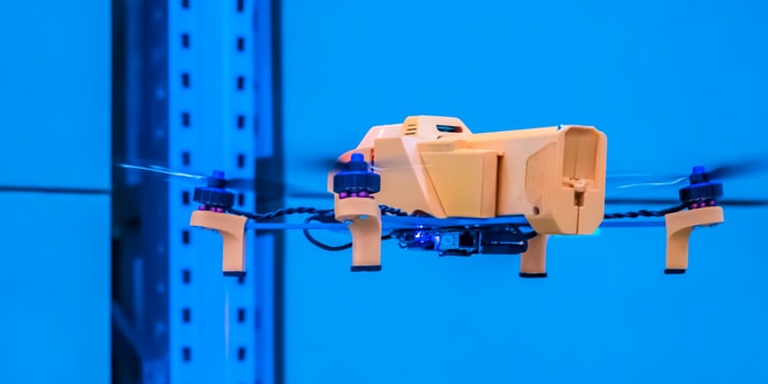
In today’s world, drones are becoming increasingly popular for a variety of applications ranging from photography to search and rescue. As a result, it is essential that any drone operator or developer has the proper tools available to ensure safe operations. One such tool is drone simulation technology, which provides users and developers with a realistic environment to test their aircraft without risking damage.
Drone simulations allow engineers and developers to experiment safely while also providing pilots with invaluable training resources for familiarizing themselves with operating their drones before flying them live in real-world scenarios.
In addition to providing realistic simulations for practice, this drone technology also offers key insights into how drones are being used by industry professionals today. By leveraging drone simulation technologies, businesses can ensure their employees are properly trained while gaining valuable insights into how they can best leverage these innovative tools.
The benefits of drone simulation technology are numerous. In addition to creating an environment where operators can gain experience before piloting an actual drone, this software provides a highly customizable environment. Operators can adjust various aspects such as terrain type and topography, weather conditions, and more.
Another important feature of drone simulation software is the ability to simulate various drones from different manufacturers. This allows operators as well as organizations building their UAV fleets to become familiar with a variety of models so they can determine which models they should consider investing in that are best suited to meet their specific requirements.
Additionally, drone simulation software provides detailed analytics about each flight’s performance after completion, allowing users to gain insights into what went right or wrong so they can make adjustments and hone their skills over time.
Many types of drone simulation software also support virtual reality (VR) experiences which offer an even more immersive way to practice using drones. By putting users inside a simulated environment where they can use joysticks or hand controls to maneuver their drones just like they would in real life, this technology ensures that users gain an accurate sense of what it will be like to operate drones in reality.
Drone simulation software also provides actionable insights to organizations using commercial drone systems by identifying their drone’s reliability when handling unexpected disruptions or failures, or the optimal load capacity and flight times for a particular job. This software can assist organizations in learning the impact of regulatory restrictions on their drone systems, and it can also conduct disaster recovery planning and exercises in a virtual environment. During simulation, drone systems can test certain constraints in different environments and help organizations improve safety protocols.
A drone simulator is a software tool that allows users to imitate the experience of flying a drone by connecting an actual drone controller to a compatible device. The simulator emulates a real drone’s flight and the forces they are designed to face outside. A drone’s performance is measured by many factors and captured by the simulation to evaluate behavior and performance under real environmental conditions. These simulators are built by experts in the industry, such as robotics and software companies, as well as training institutes. There are many types of simulators available on the market. Here are the two most commonly used types:
Software In The Loop (SITL) is a simulation software that enables users to model and control a virtual UAV with realistic flight characteristics to test their operations and flight plans for various scenarios. SITL can simulate the behavior of drones, from basic movements like hovering or turning to complex maneuvers such as obstacle avoidance and formation flying. It also allows users to test how the drone’s onboard sensors, such as its camera or GPS unit, will respond in different environments without jeopardizing the drone.
The main advantage of using SITL is that it accurately represents how a UAV would behave while in flight. This not only allows developers and operators to develop new strategies and algorithms for controlling their drones, but it also serves as an invaluable training tool before they go out into the field with a live aircraft. With SITL simulations, pilots can become comfortable operating their drones in various environments, practice performing tight maneuvers, and even familiarize themselves with the overall performance and features of different types of drones.
SITL simulations are also useful for simulating emergencies that may occur during flights. For example, a UAV could lose contact with its remote controller or experience an unexpected failure mid-flight. Fortunately, its onboard emergency protocols can be tested and evaluated through SITL simulations prior to deployment in the field. By simulating these emergency protocols in advance, operators can prepare for any potential mishaps that may arise during actual flights.
Hardware In The Loop (HIL) technology this type of simulation software is used to test the operation and performance of physical systems, such as drones or UAVs, in a realistic environment. Unlike SITL simulations which rely on virtual models and abstract parameters to simulate flight characteristics, HIL simulators use actual physical components to replicate the various mechanisms onboard a UAV, such as its sensors, actuators, and control systems. By doing so, HIL simulations can accurately model how the drone would respond under real-world conditions without requiring any physical tests to be conducted.
HIL simulators are typically composed of three main components: a simulator platform, an interface between the platform and the device being tested, and a series of software tools that create realistic scenarios for testing purposes. To run an HIL simulation, users must first select their desired conditions (such as wind speed, temperature, etc.) to generate the desired environment for the drone. Then, they must connect the simulator platform with their UAV hardware via an interface such as USB. Once connected, they can begin running their simulated scenarios on a computer or specialized hardware designed for HIL simulations.
The primary benefit of using HIL simulators is the ability to test drones without putting them at risk. Additionally, as opposed to SITL simulations which rely heavily on theoretical models, HIL simulations are much more accurate since they take into account all of the actual physical components onboard a UAV, such as its sensors and control systems.
Drone simulation technologies are invaluable tools for any drone operator or developer. By providing a safe and realistic environment to test the performance of drones without compromising the actual equipment, drone simulations can help engineers and developers ensure that their designs will work properly in any situation before deploying them out into the field.
Software providers can enlist expert-level software developers to incorporate innovative features that will enhance their drone simulation technology solutions and support their end-user clients in making tactical decisions based on insights gained from testing. As advances in both software and hardware platforms continue to be made available at lower costs than ever before, it is clear that drone simulation technology will remain an essential part of ensuring safe aerial operations worldwide.
Disclaimer:
Chetu, Inc. does not affect the opinion of this article. Any mention of specific names for software, companies or individuals does not constitute an endorsement from either party unless otherwise specified. All case studies and blogs are written with the full cooperation, knowledge and participation of the individuals mentioned. This blog should not be construed as legal advice.
Chetu was incorporated in 2000 and is headquartered in Florida. We deliver World-Class Software Development Solutions serving entrepreneurs to Fortune 500 clients. Our services include process and systems design, package implementation, custom development, business intelligence and reporting, systems integration, as well as testing, maintenance and support. Chetu's expertise spans across the entire IT spectrum.
- See more at: www.chetu.com/blogs
Join the conversation
Privacy Policy | Legal Policy | Careers | Sitemap | Referral | Contact Us
Copyright © 2000-2024 Chetu Inc. All Rights Reserved.


 By: Kelli Muniz