Let's Talk ! ![]() 954 342 5676
954 342 5676 ![]() +44 137 243 2466
+44 137 243 2466
Humans have long used particular forms of measurement as they allowed us to build infrastructure, grow crops, and cultivate an advanced society. We have advanced far from using our hands or rulers as measurements, and familiar methods of measuring and surveying are becoming a thing of the past.
Traditional surveying methods were developed for making linear measurements of a space or building for leveling. These methods usually involve the help of digitally aided manual measurements. This strategy produces analog results and entails more manual input.
The data processing phase in traditional surveying is often time-consuming, requiring meticulous analysis of collected data. Delays in obtaining survey results can impede decision-making processes for organizations. In contrast, drone photogrammetry streamlines the data collection by capturing high-resolution aerial images, allowing for quicker and more accurate mapping.
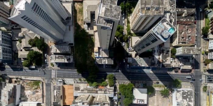
Drone photogrammetry addresses these challenges faced by traditional surveying by providing a more efficient and accurate alternative. Drones can cover large areas, decreasing the time and staffing required for surveying. The aerial perspective enables comprehensive coverage, making surveying expansive landscapes and inaccessible terrains easier. Moreover, the collected data can be processed rapidly, allowing organizations to make informed decisions promptly.
Drone mapping services have seen a spike in demand post-COVID. Construction resumed activity and has begun implementing cost and time-effective practices like drone photogrammetry to mitigate high costs and unsafe work environments. Terrestrial surveying can be dangerous for employees if the terrain is steep or precarious. Harnessing drone photogrammetry can provide net savings of $114,00 annually.
Drone photogrammetry has transformed various industries, revolutionizing traditional data collection, mapping, and surveying methods. This innovative approach utilizes unmanned aerial vehicles equipped with advanced cameras to capture high-resolution imagery, enabling the creation of accurate 3D models and geospatial data. Photogrammetry has origins that date back to WW1 when photography and manned flights were combined to gather intel from behind enemy lines. Leaders in this strategy used local landmarks and landscape features to determine the orientations of objects in the image. Today, photogrammetric maps are constructed using advanced GIS software to generate surveyor-grade landscape and infrastructure measurements.
Drone photogrammetry has two key steps: image capture and image processing. Image capture can be done with a still or video camera mounted on a drone. 3D modeling drones capture many high-resolution images of an area and overlay them with each other to make the same point on the ground visible from different angles and elevations.
Image processing is conducted manually or using photogrammetry software, combining or "stitching" the images into a high-resolution orthomosaic aerial map and 3D model. The software corrects for distortions in the camera sensor and lens and errors caused by terrain variations, resulting in high-quality maps and 3D models.
Unmanned aerial vehicles (UAVs), also known as drones, play a crucial role in capturing high-resolution images through drone photogrammetry. It has revolutionized various industries by providing efficient and precise methods for aerial data acquisition.
UAVs are equipped with high-quality cameras that capture images from elevated perspectives. The images cover large areas and comprehensively depict landscapes, structures, and environments. They can capture images at extremely high resolutions, offering detailed and sharp visuals. Drones significantly enhance the speed and efficiency of data collection compared to traditional methods. A recent Journal of Unmanned Vehicle Systems study states that a drone with the right capabilities is accurate enough to supplement or replace terrestrial survey methods for many applications. Using ground-based methods, they quickly cover large areas in a fraction of the time it would take.
While obtaining UAV technology is a financial investment, the long-term benefits of efficiency, speed, and reduced manpower often outweigh the costs. UAVs are subject to regulations, and operators must comply with local aviation authorities.
Photogrammetric techniques create detailed 3D maps using images captured from different angles. It extracts three-dimensional information from two-dimensional images and is crucial for surveying, mapping, and modeling applications.
High-resolution images are captured using cameras mounted on UAVs or other platforms. Multiple images of the same area are taken from different positions and orientations.
Common features within the images, such as identifiable points or objects, are extracted using photogrammetric software. These features serve as reference points for aligning and stitching the images together.
Bundle adjustment is a critical step that involves reining the positions and orientations of the images relative to each other. This process ensures that the images are accurately aligned in a three-dimensional space.
Photogrammetric software uses their extraction features and creates a dense point cloud representing the three-dimensional coordinates of the objects in the scene. The point cloud serves as the foundation for building the 3D model.
The point cloud is used to generate a surface model, which represents the geometry of the objects in the environment. Triangulation and interpolation techniques are applied to create a continuous surface.
High-resolution images captured during the initial phase are mapped onto the 3D model to provide realistic textures. This step enhances the visual appearance of the model.
Capturing images from different angles allows for a more complete picture and understanding of the scene, leading to increased accuracy in the 3D model. It helps overcome challenges such as shadowing, reflections, and obstructions from a single viewpoint.
Accurate 3D maps are essential for urban planning, environmental monitoring, infrastructure design, and other fields. Enhanced accuracy in 3D mapping supports better decision-making, as stakeholders can rely on detailed and reliable spatial information.
Cutting-edge techniques in geospatial data processing include LiDAR integration, orthophoto generation, and point cloud processing. Each technique plays an important role in the accuracy and richness of spatial information. Additionally, relevant software and technologies, such as Pix4D, Software DJI, Agisoft Metashape, OpenDroneMap, and programming languages like Python, contribute to the customizations and optimization of these processes.
Light detection and ranging (LIDAR) is a remote sensing technology that uses laser light to measure distances. Integrating LiDAR data with other geospatial information enhances the precision of elevation models, providing highly accurate topographic details. Tools like Pix4D and Agisoft Metashape support LiDAR integration, enabling the fusion of LiDAR point clouds with imagery for comprehensive 3D mapping.
Orthophotos are geometrically corrected aerial images that represent the Earth's surface distortion-free. Generating orthophotos is essential for accurate mapping, land surveying, and visualizing landscapes without perspective distortions. Agisoft Metashape and Pix4D are widely used for orthophoto generation. They process aerial imagery to produce high-resolution, georeferenced orthophotos suitable for various applications.
Point clouds represent a collection of 3D points in space, often generated through LiDAR or photogrammetric methods. Processing point clouds involves organizing and analyzing these data to create detailed 3D models of landscapes, structures, or objects. Pix4D and Agisoft Metashape support point cloud processing, allowing users to derive meaningful information from the captured 3D point cloud data.
Pix4D: A photogrammetry software that supports processing drone-captured imagery to generate accurate 3D models, point clouds, and orthophotos.
Software DJI: Provides software solutions for processing data captured by drone platforms, offering tools for mapping, surveying, and inspection.
Agisoft Metashape: This software combines photogrammetric and LiDar data processing capabilities, facilitating the creation of detailed 3D models, orthophotos, and point clouds.
OpenDroneMap: An open-source tool for processing drone imagery, OpenDroneMap offers functionalities for creating georeferenced maps, point clouds, and textured 3D models.
Python: This programming language is commonly used to customize and automate geospatial data processing workflows. Libraries like GDAL and PyQGIS are popular for working with GIS data.
In LiDAR systems, laser pulses are emitted from a sensor, and the time it takes for the laser to return after hitting an object is used to calculate distances. LiDAR can capture precise elevation data and provide highly accurate topographic information.
LiDAR delivers accurate and precise elevation measurements, making it ideal for terrain modeling and mapping. LiDAR can penetrate vegetation, allowing for the mapping of ground surfaces even in densely vegetated areas. It effectively detects elevation changes, making it valuable for monitoring terrain alterations over time.
While LiDAR offers many advantages, some flaws should be considered. LiDAR is expensive to deploy in terms of equipment and data processing. Additionally, LiDAR data primarily provides elevation information and lacks color data, which might be important for certain applications.
Photogrammetry can be more cost-effective, especially when using images captured by drones or traditional cameras. Photogrammetry captures detailed color information, which is beneficial for applications that require realistic visual representation. Photogrammetry is versatile and applicable in various fields, from surveying and mapping to cultural heritage documentation.
However, the quality of photogrammetric results can be influenced by lighting conditions during image capture. It may face challenges in areas with dense vegetation, as it relies on the visibility of features in the images.
Fusing LiDAR and photogrammetry allows the creation of a unified 3D point cloud, seamlessly integrating the accurate elevation data from LIDAR with the visual information captured through photogrammetry. This unified output represents a holistic representation of the surveyed area, combining both technologies' strengths to provide a more complete and detailed dataset.
Integrating LiDar's precise elevation measurements and photogrammetry's detailed visual information produces a point cloud with exceptional precision. It benefits topographic mapping, urban planning, and infrastructure design applications.
The point cloud achieves comprehensive coverage with LiDAR and photogrammetric technology, overcoming limitations associated with individual methods. While LiDAR systems can be expensive, fusion with photogrammetry offers a cost-effective solution. Drones equipped with cameras for photogrammetric data capture can complement LiDAR systems, providing a more economical and powerful surveying tool. The unified 3D point cloud enhances visualization capabilities, allowing surveyors, planners, and researchers to explore and analyze spatial data with unprecedented detail. It is instrumental in decision-making processes related to land use, environmental monitoring, and infrastructure development. The fusion of LiDAR' and photogrammetry enhances the versatility of point cloud data, making it applicable in various industries.
Integrating LiDAR and photogrammetry point clouds presents a transformative competitive edge in surveying and spatial data applications. We harness the strengths of both technologies so that the fused point cloud achieves superior outcomes and fills the critical gaps that were previously challenging to address. Traditional LiDAR point clouds may need more visual details, while photogrammetric point clouds might need help with elevation precision. The combined point cloud offers unparalleled accuracy and detail by integrating LiDAR's precise elevation measurements with the rich visual information captured through photogrammetry. It results in a comprehensive 3D representation that exceeds the capabilities of individual datasets.
LiDAR struggles to penetrate dense vegetation, limiting its effectiveness in capturing the ground elevation in such environments. The fusion with photogrammetry addresses this gap by leveraging the ability of photogrammetry to capture visual features even in densely vegetated areas. The combined point cloud provides complete coverage, overcoming the limitations associated with individual technologies.
LiDAR systems can be expensive to deploy, restricting their widespread use in certain projects. The integration with photogrammetry introduces a cost-effective solution. Drones equipped with cameras for photogrammetric data capture complement LiDAR systems, allowing for a more economical yet powerful surveying tool. This cost-effective approach enhances accessibility and competitiveness in the surveying industry.
Traditional point clouds may lack the visual richness required for detailed analysis and decision-making. The unified 3D point cloud enhances visualization capabilities, allowing stakeholders to explore and analyze spatial data with unprecedented detail.
Certain industries face challenges in finding a solution that caters to their diverse spatial data needs. The fused point cloud's versatility accommodates various applications, from forestry and agriculture to archaeology and disaster response. This adaptability across industries gives organizations a competitive edge by providing a single, comprehensive solution for diverse spatial data requirements.
Drone photogrammetry has emerged as a versatile technology with transformative applications across various industries. In agriculture, drone photogrammetry goes beyond capturing stunning aerial images; it plays a pivotal role in crop monitoring and terrain management. A drone with high-resolution cameras enables farmers to obtain detailed insights into crop health, identify potential issues, and optimize terrain conditions. It manages large fields by efficient soil analysis, disruptions in the irrigation system, and comparing crop growth to previous years. The real-time data generated through drone photogrammetry becomes a game-changer in agricultural decision-making, providing farmers with timely information to enhance productivity and yield.
In the construction and infrastructure sectors, drone photogrammetry is a dynamic tool for site planning and progress monitoring. The ability to capture high-resolution aerial images facilitates accurate site assessments, aiding in efficient project planning. Drones equipped with photogrammetric capabilities contribute to progress monitoring, allowing stakeholders to track construction advancements precisely. A survey conducted by Goldman Sachs estimated that using drones in construction could contribute over $2.5 billion annually. Research by PwC suggests that by 2030, construction drones could contribute over $45.2 billion to the global economy. Moreover, the technology is increasingly valuable in infrastructure inspection and maintenance, providing detailed visual data that helps identify potential issues and ensures the longevity of critical structures.
Drones are equipped with advanced technology like 3D imaging, GPS sensors, advanced cameras, and Artificial Intelligence, escalating the demand for accident reconstruction, terrestrial scene reconstruction, and faster documentation of events with speed and accuracy.
In resource-related industries like oil & gas and mining, drone photogrammetry has found crucial applications in pipeline inspection and mining site mapping. Drones navigate challenging terrains to capture detailed images, supporting efficient inspection processes. The technology's contribution to enhancing safety and efficiency is noteworthy, as it proactively identifies potential hazards, reducing risks associated with resource extraction and transportation. Drone photogrammetry emerges as a cornerstone in streamlining operations and decision-making across agriculture, construction, and resource-related industries, showcasing its adaptability and transformative impact on diverse sectors.
We understand industry pain points and stand at the forefront of delivering customized solutions to address specific challenges across diverse sectors. Our experts specialize in drone software development, offering innovative solutions that cater to the needs of industries. We harness swarm technologies for efficient drone coordination, optimize video streaming capabilities for real-time insights, incorporate Machine Learning for data analysis, and implement real-time analytics for informed decision-making. Our drone software solutions are meticulously designed to meet the unique demands of each industry.
Drone photogrammetry has a great impact because of its ability to provide real-time insights, enhance decision-making, and streamline operations. Adopting drone photogrammetry for businesses seeking a competitive edge translates to improved efficiency, cost-effectiveness, and unparalleled precision in data capture. Harnessing the power of drone photogrammetry results in optimized processes, increased productivity, and informed decision-making.
As experts in tailored drone software development, we bring a wealth of experience and a commitment to delivering solutions that directly address your business needs. Contact us to hire an expert software developer to unlock the full potential of drone technology.
Disclaimer:
This content has been made available for information purposes only. Views and opinions expressed in this content are those of the individual author only and do not necessarily represent the opinions and views of Chetu. Chetu, and its representatives, make no representation or warranty of any kind, express or implied, regarding the accuracy, adequacy, validity, reliability, availability, or completeness of any information of this content. Under no circumstances shall Chetu, or its representatives, have any liability to you or any loss or damage of any kind incurred as a result of the use of this content or reliance on any information provided in this content. Your use of this website and your reliance on any information on this content is solely at your own risk.
About Chetu:
Founded in 2000, Chetu empowers businesses with AI and digital transformation solutions, supporting startups, SMBs, and Fortune 5000 companies. We deliver end-to-end software solutions backed by global digital intelligence and industry expertise. Our customized software delivery model and one-stop-shop approach span the full technology spectrum. Headquartered in Sunrise, Florida, Chetu operates 13 locations across the U.S., Europe, and Asia.
See more at: Chetu Blogs
Limited Time Offer for a Free E-Book
Privacy Policy | Legal Policy | Careers | Sitemap | Referral | Contact Us
Copyright © 2000- 2026 Chetu Inc. All Rights Reserved.

 By: Kelli Muniz