Let's Talk ! ![]() (954) 862 3937
(954) 862 3937
By: Pravin Vazirani
REQUEST A CONSULTIn recent years, we have witnessed the rapid acceleration of Geographic Information Systems (GIS) technology and applications, which allow users to intelligently analyze demographic and geographic information. In the past, companies have used GIS systems to make better decisions about real estate, such as where to buy a commercial property and gain access to certain customers based on specific locations. Geographic Information Systems have come a long way since then.
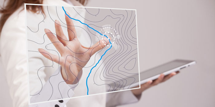
Geographic Information Systems (GIS) allows users to visualize, interpret and analyze data to understand relationships, patterns, trends and more. In today's business setting, understanding the spatial relationships between your business, suppliers, and customers can vastly boost your company performance.
GIS business users have a higher possibility of improving profit margins and advertising campaigns. Geographic Information Systems can even help your company locate new and profitable office space, calculate more efficient delivery routes, and identify new consumer trends that are either promoting business growth or decline, details for you to address accordingly.
Esri, a leading GIS software development company understands the importance of developing such a robust platform. It's no surprise Esri is a popular choice among businesses, after all they have built the world's most powerful mapping and analytics software: ArcGIS.
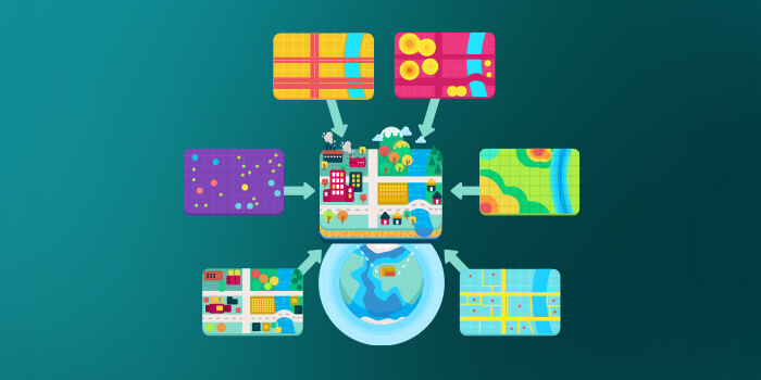
ArcGIS is backed with a set of unique tools and capabilities including spatial analytics, imagery and remote sensing, mapping and visualization, real-time-GIS, 3D GIS, and data collection and management that business leverage on for location-based and data analytics. ArcGIS allows users to collaborate with others, sharing their insights via maps, applications and reports.
Spatial Analytics helps business build a complete and in-depth overview of a particular location. Having access to such information, helps companies identify profitable geographical markets suitable for a new store or office, based on accurate location pattern and relationship analysis.
ArcGIS Imagery and remote-sensing gives companies' access to a massive collection of the world's base maps, full motion videos, location elevations, aerial images, and more, helping users experience different aspects of the world at a high-resolution level.
Using ArcGIS powerful mapping and visualization toolset, companies can create interactive maps, custom consumer maps, data maps and more, based on a location spatial patterns. Users can also use this data to build environments in 3D and address any possible problems or identify trends and more, helping them see the bigger picture and share it with others.
One of the most crucial and popular features of ArcGIS is its real-time GIS system that alerts key personal of all activity happening at a certain place or event, so they can take appropriate actions to keep everything running smoothly and safely. Businesses can also track their assets, access real-time social media feeds and more.
As an Esri service provider, Chetu has extensive experience amplifying, boosting and accelerating ArcGIS so its customers can pretty much accomplish anything. Chetu provides its customers with custom implementation, support and integration services for ArcGIS.
If you are looking to implement Esri but aren't sure how it works, don't worry we got you covered. Our ArcGIS developer have plenty of industry experience to analyze your business, install Esri and seamlessly migrate any business data to the platform, while ensuring data integrity and security.
Our ArcGIS developer configure and customize Esri GIS platform with industry specific features, applications and functionalities that add more value to your GIS, enhance user experience, giving companies the competitive advantage to deliver projects on time and budget. Also, if businesses currently use any other software or applications, Chetu can improve overall efficiency and workflow by integrating those systems to your GIS platform.
As you can see Geographic Informational Systems are clearly a valuable software in a business setting. If you still need more convincing or have any questions give Chetu a call today, and we will give you more in-depth information on how GIS technologies can help improve your business and increase your profit margins. Having a GIS software can revolutionize and improve your business strategy and enable your users to identify important patterns and relationships that you didn't know existed.
Disclaimer:
This content has been made available for information purposes only. Views and opinions expressed in this content are those of the individual author only and do not necessarily represent the opinions and views of Chetu. Chetu, and its representatives, make no representation or warranty of any kind, express or implied, regarding the accuracy, adequacy, validity, reliability, availability, or completeness of any information of this content. Under no circumstances shall Chetu, or its representatives, have any liability to you or any loss or damage of any kind incurred as a result of the use of this content or reliance on any information provided in this content. Your use of this website and your reliance on any information on this content is solely at your own risk.
About Chetu:
Founded in 2000, Chetu empowers businesses with AI and digital transformation solutions, supporting startups, SMBs, and Fortune 5000 companies. We deliver end-to-end software solutions backed by global digital intelligence and industry expertise. Our customized software delivery model and one-stop-shop approach span the full technology spectrum. Headquartered in Sunrise, Florida, Chetu operates 13 locations across the U.S., Europe, and Asia.
See more at: Chetu Blogs
Limited Time Offer for a Free E-Book
Privacy Policy | Legal Policy | Careers | Sitemap | Referral | Contact Us
Copyright © 2000- 2026 Chetu Inc. All Rights Reserved.