Let's Talk ! ![]() 954 342 5676
954 342 5676 ![]() +44 137 243 2466
+44 137 243 2466
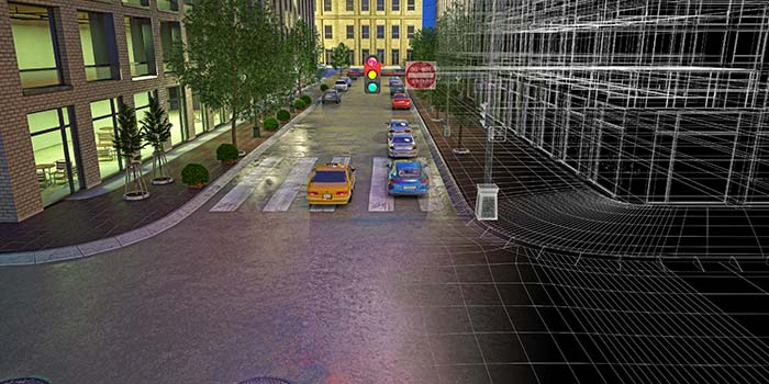
Civil 3D corridors play a vital role in infrastructure design by providing a dynamic 3D modeling tool within the Civil 3D software. Corridors essentially represent the linear components of a project, like roads or railway tracks, and help streamline the design process. They consist of alignments, profiles, and assemblies, enabling engineers to visualize and evaluate how different design components interact in a 3D environment, ensuring more precise, customized and accurate project outcomes.
Corridors benefit various project types by enhancing road design through better visualization of intersections and grading, optimizing site grading by integrating various design elements more efficiently, and aiding in railway design by enabling the creation of smoother track alignments. For stakeholders, corridors offer improved coordination among design team members, better decision-making capabilities through realistic 3D simulations, and optimized construction processes by reducing errors and rework. By leveraging Civil 3D corridors, infrastructure projects are optimized for increased efficiency, collaboration, and overall project success.
Civil 3D corridors enable rapid design changes through their dynamic modeling capabilities. When a corridor's underlying alignment, profile, or cross-sectional assembly is modified, the model automatically updates in real time. This design automation reduces manual adjustments and ensures consistency across the project. By streamlining updates, corridors enhance productivity and allow engineers to evaluate multiple design scenarios efficiently, improving decision-making and reducing project timelines.
Civil 3D corridors smoothly blend into current CAD and BIM workflows, fostering teamwork and uniform data. With features like Data Shortcuts and file exports, corridors can easily exchange information across various fields, ensuring harmony with overall project models. This corridor interoperability promotes collaboration among architects, engineers, and contractors. Additionally, sharing corridor data with BIM platforms enables stakeholders to visually assess project specifics and enhance communication for more efficient construction planning.
Civil 3D corridors utilize intelligent objects and parametric relationships to improve design accuracy. Each corridor is constructed using assemblies and subassemblies, which define the cross-sectional components of the model, such as lanes, curbs, and ditches. These components are linked to corridor parameters, allowing for dynamic adjustments based on design inputs. For example, changes to a road’s width or slope automatically update the corridor geometry, ensuring precise and consistent modeling.
Civil 3D corridors effectively handle complex projects through support for multiple baseline corridors. Each baseline represents a unique alignment and profile, allowing engineers to model intricate designs like multi-lane roads, split-level highways, or rail systems. Additionally, corridors can be divided into regions, enabling targeted control of design elements such as widening lanes or changing materials. This level of corridor management ensures accuracy and flexibility, making it easier to tackle sophisticated infrastructure projects.
Civil 3D corridors enhance data management through data shortcuts and project data references. Data shortcuts allow teams to share alignments, profiles, and corridor data across multiple files, ensuring consistency and reducing duplication. By using project data references, teams can access updated corridor designs in real time, fostering collaboration and improving project efficiency. These tools streamline workflows, making corridor data accessible to all project stakeholders.
Utilizing corridors boosts team communication with a centralized approach that seamlessly connects with scheduling and documentation tools. With features like quantity takeoffs, visualizations, and detailed design documentation, corridors elevate construction scheduling and coordination. Engineers, contractors, and project managers can easily access precise, current models for smooth corridor collaboration. This ultimately reduces mistakes and misunderstandings, guaranteeing that all teams align towards a cohesive project vision.
Civil 3D corridors enable precise quantity takeoffs by dynamically calculating materials, earthwork volumes, and other construction quantities based on the corridor geometry. By leveraging earthwork optimization tools, engineers can minimize material waste and reduce costs. These accurate data outputs ensure reliable cost estimation, allowing project teams to budget effectively and avoid unexpected expenses.
Corridors integrate with advanced analysis tools to evaluate and optimize designs. For instance, engineers can use tools for slope stability, drainage behavior, and traffic flow to ensure the corridor meets all performance requirements. These features support corridor optimization, helping teams identify design inefficiencies and make informed decisions that improve functionality and reduce costs. This analytical approach ensures that the final design is both efficient and sustainable.
Civil 3D corridors revolutionize efficiency, accuracy, and collaboration in infrastructure projects. By automating design updates, integrating with CAD and BIM workflows, and offering advanced analysis tools, corridors streamline processes and enhance project outcomes. Their ability to handle complex designs, facilitate accurate quantity takeoffs, and improve communication between teams is essential in modern engineering. Unlock the full potential of your infrastructure projects with Civil 3D corridors. Whether it's for roads, railways, or site grading, these corridors empower stakeholders to streamline designs, cut costs, and efficiently reach project goals. Elevate your projects to the next level by exploring the powerful capabilities of Civil 3D corridors.
Disclaimer:
This content has been made available for information purposes only. Views and opinions expressed in this content are those of the individual author only and do not necessarily represent the opinions and views of Chetu. Chetu, and its representatives, make no representation or warranty of any kind, express or implied, regarding the accuracy, adequacy, validity, reliability, availability, or completeness of any information of this content. Under no circumstances shall Chetu, or its representatives, have any liability to you or any loss or damage of any kind incurred as a result of the use of this content or reliance on any information provided in this content. Your use of this website and your reliance on any information on this content is solely at your own risk.
About Chetu:
Founded in 2000, Chetu empowers businesses with AI and digital transformation solutions, supporting startups, SMBs, and Fortune 5000 companies. We deliver end-to-end software solutions backed by global digital intelligence and industry expertise. Our customized software delivery model and one-stop-shop approach span the full technology spectrum. Headquartered in Sunrise, Florida, Chetu operates 13 locations across the U.S., Europe, and Asia.
See more at: Chetu Blogs
Limited Time Offer for a Free E-Book
Privacy Policy | Legal Policy | Careers | Sitemap | Referral | Contact Us
Copyright © 2000- 2026 Chetu Inc. All Rights Reserved.

 By: Jeff Parcheta